More photos...
click images to enlarge
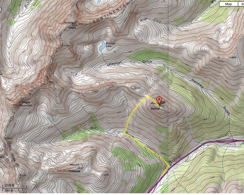
Coordinates (lat, long): 39.70982, -105.87845
Mileage (round trip): 4.2 mi (6.7 km)
Cumulative Elevation Gain: 2100 ft (640 m)
Max Altitude: 12705 ft (3872 m)
Trailhead: Dry Gulch Trailhead (39.69204, -105.87942)
Date(s) Hiked: 19-MAY-12
Duration (round trip): 5.5 hrs