click images to enlarge
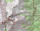
Coordinates (lat, long): 40.25493, -105.61554
Mileage (round trip): 14.5 mi (23.3 km)
Cumulative Elevation Gain: 5,100 ft (1,554 m)
Max Altitude: 14,255 ft (4,345 m)
Trailhead: Longs Peak Trailhead (40.27215, -105.55664)
Date(s) Hiked: 9-SEP-12
Duration (round trip): 12 hrs