More photos...
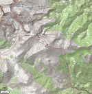
click images to enlarge
Coordinates (lat, long): 39.55610, -105.60639
Mileage (round trip): 9.0 mi (14.6 km)
Cumulative Elevation Gain: 4300 ft (1310 m)
Max Altitude: 13575 ft (4138 m)
Trailhead: Deer Creek Trailhead (39.51063, -105.56733)
Date(s) Hiked: 29-APR-12
Duration (round trip): 7 hrs